What is natural geography?
Natural geography is the field of geography that studies the interaction between nature and humans from spatial and regional perspectives. Natural geography is a part of the larger field of geoscience or Earth science. This field consists of natural sciences that study the Earth and its atmosphere.
Natural geography observes, studies and explains:
- the natural environment and the spatial distribution of its features, for example the location and changes in the northern coniferous forest belt
- the regional natural systems in the environment, for example the absorption of groundwater in a given area
- spatial manifestations of human-nature interactions, for example the impact of logging on the occurrence of white-tailed woodpeckers in the old broadleaf forests of Northern Europe.
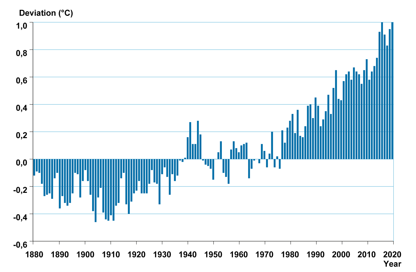
Natural geography studies climate, the water cycle, landforms and the distribution of organisms and their interactions. Research topics cover a wide range of natural processes, such as earthquakes, floods or the effects of climate change on the evolution of species.
Natural geography studies the role of geographic location in the phenomenon under study and examines the relationship between environmental changes and a wide range of factors that are constantly changing in the area under study.
The spatial and temporal coverage of natural geography can vary widely. Natural geography can focus on the planet as a whole, on specific continents (e.g. Eurasia), on large geographic areas (e.g. the Alps) or on quite small areas and units (e.g. a single meadow, plant or animal). Phenomena can also be examined over long periods of time.
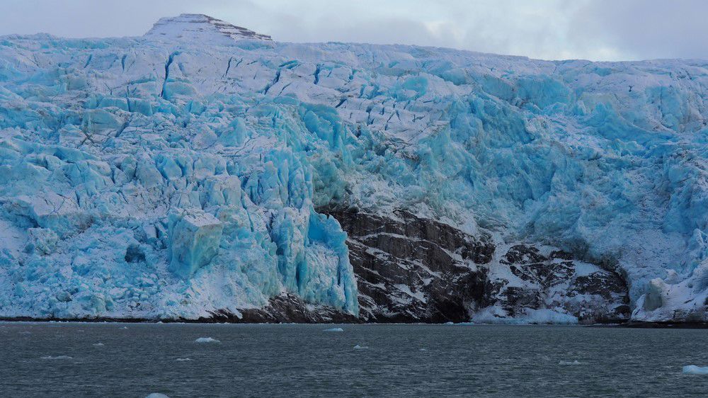
The medium-term time scales of natural geography research range from years to decades, allowing geographers to observe phenomena such as the melting or movement of a glacier in a mountain valley. A short-term phenomenon, such as a flood caused by melting glaciers, can last from hours to days.
The foundations of natural geographic knowledge come from basic research, which is based on general explanatory models. These are theories and concepts that concern the phenomena under study. Experimental research often investigates the effect of one or two variables on the phenomenon under study in a region.
Society directly benefits from applied research that seeks practical applications for the development of human societies and environments.
Natural geography helps us to understand the constant changes that take place in the environment and provides tools for sustainable development.
Natural geography and related sciences
Natural geography consists of many specialised fields. They are divided according to their field of study.
Specialised fields of natural geography include
- climatology, the science that studies climate and related phenomena
- hydrogeography, the science that studies of the water cycle
- geomorphology, the science that studies the shape and structure of the Earth's surface
- biogeography, the science that studies the geographic distribution of plants, animals and organisms.
Geosciences close to natural geography are
- meteorology, the science that studies atmosphere and weather
- hydrology, the science that studies the occurrence, properties and circulation of water
- geology, the science that studies the structure of the Earth and bedrock
- ecology, the science that studies the relationship between organisms and the environment
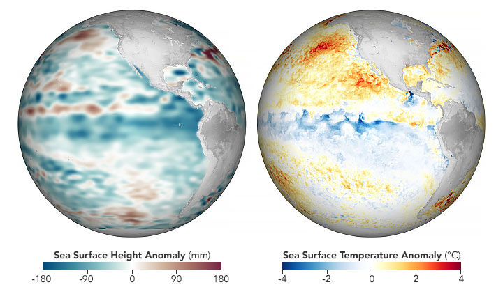
- global change, the science that studies large-scale environmental changes affecting the whole planet.
Research methods in natural geography
Natural geography is based on research that systematically collects new observational and measurement-based data on the subject under study. Research can also interpret existing data in a new way.
Most often, the researcher analyses the findings using precise and computational statistical methods and models. The researcher interprets the results obtained in the light of theories, models and previous research findings. By examining this data, the geographer understands the phenomenon they are studying and tries to make broader generalisations about it, which may extend beyond the observational data.
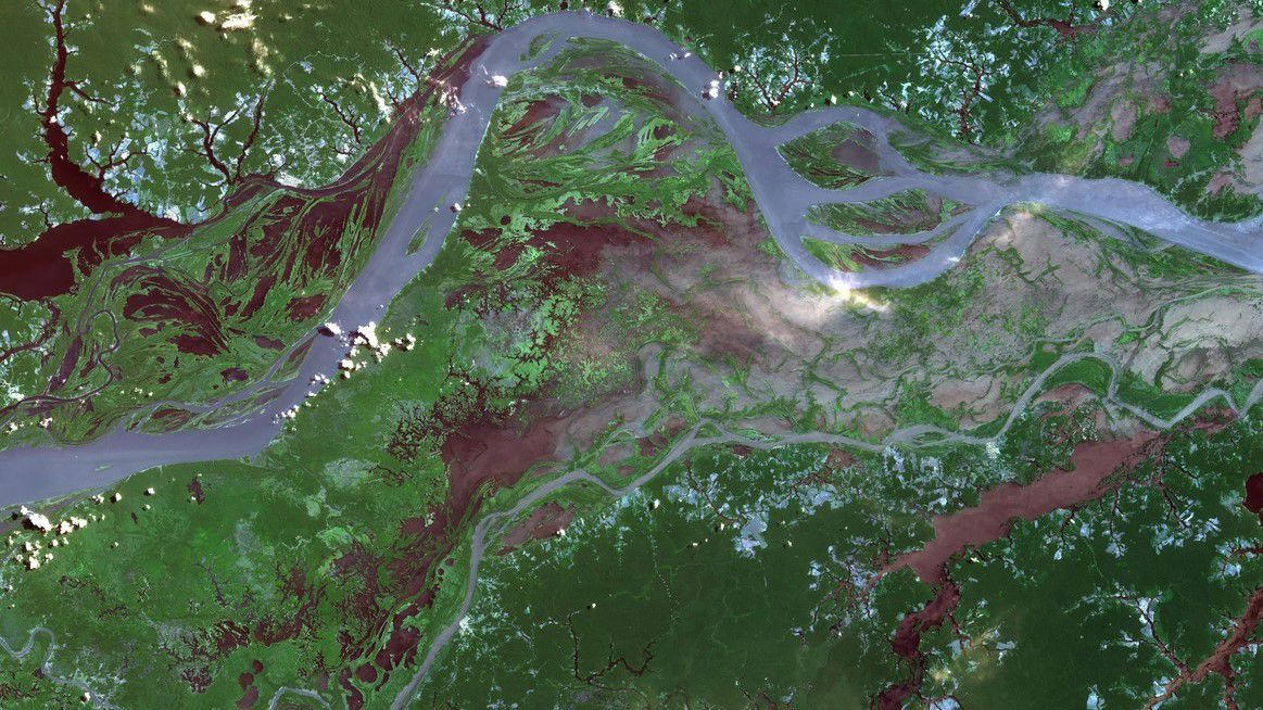
Quantitative research methods are suitable for studies involving large numbers of observations, which include many of the climatic, environmental and hydrological phenomena studied by geography. It is essential that the methods used to measure the phenomenon are reliable. The location, characteristics and spatial occurrence of the phenomenon under study are often illustrated with the help of spatial information.
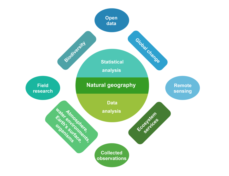
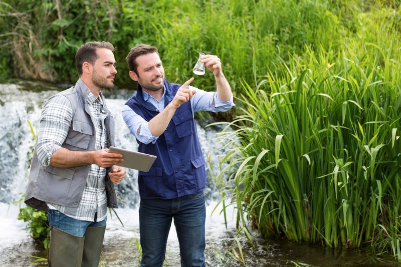
Expeditions and fieldwork have always been an integral part of research in natural geography. In these methods, the geographer goes to the site of their research and, using a variety of measuring instruments, makes the necessary observations of the environment. For example, changes in climatic weather conditions are measured using thermometers and anemometers, whereas the water cycle is studied by measuring rainfall and river flow. Landforms are studied using photographs, field drawings and soil samples.
Field surveys and the observations collected through them provide very detailed information from small areas. With these methods, it is possible to examine e.g. the impact of individual felled trees on a flying squirrel population or changes in the bottom of a single river from year to year.
Technological advances have made it possible to measure and locate the phenomena under study with great precision, ease and speed. For example, a researcher can use a drone whose precise position is continuously determined by GPS to study the shape of an area’s terrain. A camera and measurement system mounted on the drone uses laser beams to capture and measure the shapes of the surrounding environment, right down to the bottom of water. This provides three-dimensional data down to the centimetre level, enabling the exploration of large areas without touching the subject. The measurement data can be transmitted immediately by telephone, internet or satellite. The measurement can then be repeated on a yearly basis, as long-term research allows us to detect changes in the environment.
Computer models of areas can be made using precise measurement data. The virtual model can also be turned into a physical object, if necessary. This involves creating an accurate three-dimensional model of the measured environment using a 3D printer. Today, many measuring devices placed in the environment also automatically transmit the data they collect. This technology has greatly facilitated fieldwork and research in the field of natural geography.
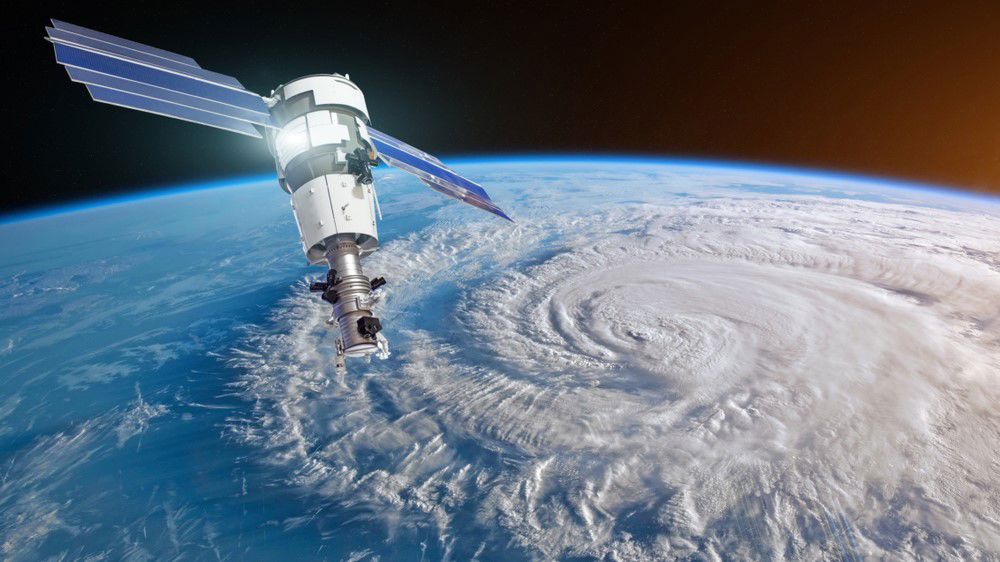
Today, more and more environmental information is also available in the form of pre-collected data. This is provided by instruments that continuously monitor the state and change of the environment around the world, and by satellites that map changes in the environment. Remote sensing is carried out by satellites that image and measure the Earth's surface and atmosphere. This data is increasingly freely available as open data, which can be accessed, edited and redistributed by anyone with access to the internet. As a result, a significant and growing proportion of natural geography research can now be carried out from an office, relying only on a laptop, internet access and off-the-shelf databases. However, a deep understanding of the role of location and spatial interactions in the phenomena and environment under study remains essential.
The results of natural geography research and forecasting models are useful and often necessary for developing the society and the local area. They are often based on many years of research into the phenomenon under consideration. For example, it is possible to study river flow and flooding over many years and use this information to map flood risk areas downstream. This is useful when planning the location of new developments in relation to the river, or when precautions for existing residents in the event of future flooding.
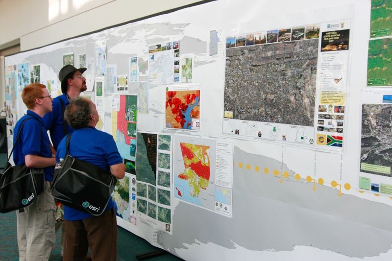
Natural geography uses geomedia to retrieve, present and manipulate geographic information. Geomedia refers to geographic information resources such as maps, images, statistics, map services and spatial data sets.
Natural geography research methods and geomedia


Summary
- Natural geography is the field of geography that studies the interaction between humans and the environment.
- Examples of the research topics of natural geography include climate (climatology), the water cycle (hydrogeography), terrain and landforms (geomorphology) and the distribution of organisms (biogeography). Natural geography also studies the interactions between these phenomena.
- Society directly benefits from applied research in natural geography. Applied research seeks practical applications for existing problems.
- Research methods used in natural geography include observation, measurement and long-term monitoring, from field surveys to remote sensing.